Great Sand Dunes National Park, located in south-central Colorado, is renowned for its massive sand dunes and diverse ecosystem. The park’s exact latitude and longitude coordinates are approximately 37.75° N and 105.5° W. This unique natural wonder spans across Saguache and Alamosa Counties, offering visitors a chance to explore the tallest dunes in North America. Understanding the park’s precise location is crucial for planning visits, navigating the area, and appreciating its geographical significance.
Great Sand Dunes National Park and Preserve is situated in the San Luis Valley of Colorado. The park’s main entrance is near the Great Sand Dunes Lodge, with GPS coordinates:
- Latitude: 37.649957° N
- Longitude: -105.586780° W
For more precise measurements, the Indian Springs Met Station near the dunes has coordinates:
- Latitude: 37.7641111° N
- Longitude: -105.6267778° W
What Are the Key Access Points to the Park?
- Main Entrance: Located near the Great Sand Dunes Lodge
- Visitor Center: Central hub for information, maps, and park store
- Main Parking Area: Near the visitor center, providing access to the dune field
- Medano Pass: Accessible by four-wheel drive vehicles (seasonal)
How Can Visitors Navigate the Park Effectively?
Navigating Great Sand Dunes National Park requires some planning. Here are key points to consider:
- Follow Highway 160 or Highway 17, then look for National Park signs
- From Highway 150, follow signs to the park entrance
- Use the visitor center as a starting point for orientation
- For dune exploration, veer left (southwest) from the parking lot to avoid footprints
What Facilities Are Available at the Park?
Great Sand Dunes National Park offers various facilities to enhance visitor experience:
- Visitor Center
- Park Store
- Restrooms
- Parking Areas
- Nearby amenities:
- Gas stations
- Restaurants
- Stores
When Is the Best Time to Visit Great Sand Dunes National Park?
The park is open year-round, but certain factors affect the best time to visit:
- Summer: Sand temperatures can be extremely high
- Late October: Ideal for photography due to favorable temperatures and scenic conditions
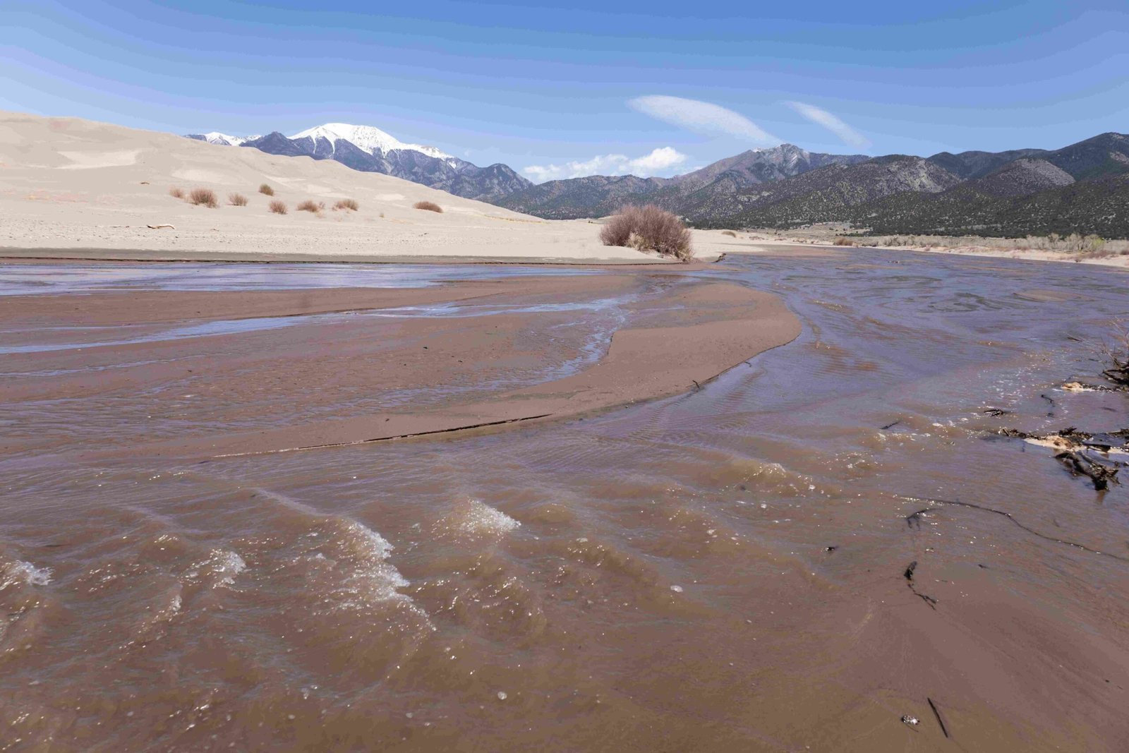
- Late May to early June: Peak flow of Medano Creek, which can affect accessibility
What Activities Can Visitors Enjoy at the Park?
Great Sand Dunes National Park offers a range of activities for visitors:
- Hiking
- Sandboarding
- Sandsledding
- Photography
- Wildlife viewing
- Stargazing
Note: Sandboarding and sandsledding equipment can be rented near the park entrance or in Alamosa.
Are There Any Special Rules or Regulations to Follow?
Visitors must adhere to park rules to protect the environment and wildlife:
- Hunting is permitted in the preserve during autumn but prohibited within national park boundaries
- Follow Leave No Trace principles
- Respect wildlife and maintain safe distances
- Obtain necessary permits for backcountry camping or special activities
How Does the Park’s Location Affect Its Ecosystem?
The unique location of Great Sand Dunes National Park contributes to its diverse ecosystem:
- Sand Dune Formation: The park’s position in the San Luis Valley, combined with prevailing winds, creates the tallest dunes in North America
- Alpine to Desert Environments: The elevation range from valley floor to mountain peaks supports various habitats
- Medano Creek: This seasonal stream is a result of snowmelt from the Sangre de Cristo Mountains
- Wildlife Diversity: The park’s varied landscapes support a wide range of animal and plant species
What Makes Great Sand Dunes National Park’s Location Unique?
Several factors contribute to the park’s unique location:
- Geographical Features:
- Tallest dunes in North America
- Sangre de Cristo Mountains as a backdrop
-
San Luis Valley’s expansive flatlands
-
Climate Characteristics:
- Arid conditions in the valley
- Alpine climate in higher elevations
-
Dramatic temperature variations
-
Geological Significance:
- Ongoing sand dune formation processes
- Visible layers of geological history in surrounding mountains
How Can Visitors Use GPS Coordinates for Park Exploration?
GPS coordinates can enhance the visitor experience at Great Sand Dunes National Park:
- Navigation: Use coordinates to find specific trailheads or points of interest
- Photography: Locate prime spots for landscape or wildlife photography
- Backcountry Exploration: Mark campsites or notable features during hikes
- Educational Purposes: Understand the park’s layout and geographical features
Visitors should always combine GPS use with park maps and ranger guidance for safe exploration.
Reference:
1. USGS Water Data: Indian Springs Met Station NR Great Sand Dunes, CO
2. Wikipedia: Great Sand Dunes National Park and Preserve
3. Great Sand Dunes Lodge: Directions