Great Sand Dunes National Park aerial view offers a breathtaking perspective of North America’s tallest dunes. This unique landscape, nestled in southern Colorado, presents a stunning contrast of golden sand against the backdrop of the Sangre de Cristo Mountains. Aerial views reveal the park’s vast expanse, intricate dune formations, and the interplay of light and shadow across the sandy terrain. While drone usage is restricted, various vantage points and alternative methods allow visitors to experience and capture the park’s grandeur from above.
What Are the Best Vantage Points for Great Sand Dunes National Park Aerial View?

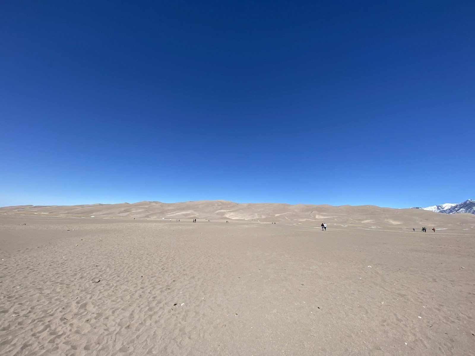
To capture the most impressive aerial views of Great Sand Dunes National Park, consider these prime locations:
- Star Dune Summit: At 750 feet tall, it offers a panoramic view of the dune field.
- High Dune: The second-highest dune provides excellent vistas of the surrounding landscape.
- Visitor Center Area: Elevated spots near the center offer expansive views of the dune field and mountains.
- Medano Creek Area: During spring and early summer, this location showcases the unique combination of flowing water and sand dunes.
For optimal photography conditions, visit during early morning or late afternoon when the light is softest and shadows are most dramatic.
What Are the Drone Regulations at Great Sand Dunes National Park?

Drone usage in Great Sand Dunes National Park is strictly regulated:
- General prohibition: Recreational drone use is not allowed within park boundaries.
- Special permissions: Drones may be used for specific purposes such as scientific research, search and rescue operations, or official park business.
- Permit requirements: A Special Use Permit from the National Park Service is mandatory for any drone operation.
- Safety guidelines: Approved drone operations must adhere to park regulations and avoid disturbing wildlife or visitors.
It’s crucial to note that these regulations are in place to preserve the park’s natural beauty and protect its ecosystem.
How Can Visitors Experience Aerial Views Without Drones?
While drone usage is restricted, there are several alternative ways to experience and capture aerial views of Great Sand Dunes National Park:
- Hiking to elevated viewpoints:
- Star Dune Trail
- High Dune Trail
-
Mosca Pass Trail
-
Scenic drives:
- Medano Pass Primitive Road (4WD required)
-
Highway 150 scenic overlooks
-
Guided tours:
- Ranger-led hikes to high points
-
Local tour operators offering specialized photography tours
-
Fixed-wing aircraft tours:
- Some local aviation companies offer scenic flights over the park (subject to regulations)
What Are the Best Times of Year for Aerial Photography at Great Sand Dunes?
The best times for aerial photography at Great Sand Dunes National Park vary depending on the desired effect:
| Season | Advantages | Challenges |
|---|---|---|
| Spring | Medano Creek flow, wildflowers | Unpredictable weather |
| Summer | Long days, clear skies | Extreme heat, crowded conditions |
| Fall | Golden aspen trees, cooler temperatures | Shorter days |
| Winter | Snow-capped dunes, fewer visitors | Cold temperatures, limited access |
For the most dramatic aerial views, consider visiting during:
- Late spring: To capture the contrast of flowing water and sand dunes
- Early fall: For the golden hues of changing aspen trees against the sand
- Winter: To photograph the unique sight of snow-covered dunes
What Equipment is Recommended for Capturing Great Sand Dunes National Park Aerial View?
To capture stunning aerial views of Great Sand Dunes National Park, consider the following equipment:
- Camera gear:
- DSLR or mirrorless camera with high-resolution sensor
- Wide-angle lens (14-24mm range)
- Telephoto lens for distant details
-
Sturdy tripod for stability
-
Filters:
- Polarizing filter to reduce glare from sand
-
Neutral density filters for long exposures
-
Accessories:
- Remote shutter release
- Extra batteries and memory cards
-
Lens cleaning kit (sand can be damaging)
-
Protection:
- Weather-sealed camera bag
- Dust covers for equipment
Remember to protect your gear from sand and extreme temperatures, which are common challenges in the park environment.
How Can Photographers Prepare for Aerial Photography at Great Sand Dunes?
Preparing for aerial photography at Great Sand Dunes National Park requires careful planning:
- Research and scouting:
- Study park maps and trail guides
- Visit the park’s official website for current conditions
-
Arrive early to scout locations before optimal light conditions
-
Physical preparation:
- Condition yourself for hiking in sand and at altitude
- Carry plenty of water and snacks
-
Wear appropriate footwear and sun protection
-
Technical preparation:
- Practice using your equipment in similar conditions
- Understand manual camera settings for varying light situations
-
Familiarize yourself with composition techniques for landscape photography
-
Logistical planning:
- Check park hours and seasonal closures
- Obtain necessary permits for commercial photography
- Plan for transportation to remote areas if needed
By thoroughly preparing, photographers can maximize their chances of capturing stunning aerial views of Great Sand Dunes National Park.
What Are the Unique Features Visible from an Aerial Perspective?
From an aerial perspective, Great Sand Dunes National Park reveals several unique features:
- Dune patterns:
- Star-shaped dunes
- Crescent dunes (barchans)
-
Linear dunes
-
Geological contrasts:
- Sand dunes against mountain backdrops
-
Transition zones between ecosystems
-
Water features:
- Medano Creek’s seasonal flow
-
Alpine lakes in the distance
-
Vegetation patterns:
- Sparse vegetation on dune edges
-
Dense forests in surrounding areas
-
Human impact:
- Hiking trails winding through the dunes
- Visitor center and facilities
These features combine to create a visually stunning and scientifically intriguing landscape when viewed from above.
How Does the Aerial View Change Throughout the Day?
The aerial view of Great Sand Dunes National Park undergoes dramatic changes throughout the day:
- Early morning: Long shadows create depth and texture in the dunes
- Midday: Harsh light flattens the landscape but reveals true sand colors
- Late afternoon: Golden hour light enhances dune ridges and creates warm tones
- Sunset: Dramatic colors paint the sky and reflect off the sand
- Night: Starry skies offer opportunities for astrophotography
To capture these changes, consider time-lapse photography from a fixed vantage point or multiple visits to the same location at different times.
By understanding these daily changes, photographers can plan their shoots to capture the most compelling aerial views of Great Sand Dunes National Park.
References:
1. https://www.thedronegirl.com/2017/01/31/colorados-great-sand-dunes-national-park-using-drones/
2. https://uavcoach.com/drones-in-national-parks/
3. https://www.americangeosciences.org/printpdf/18277